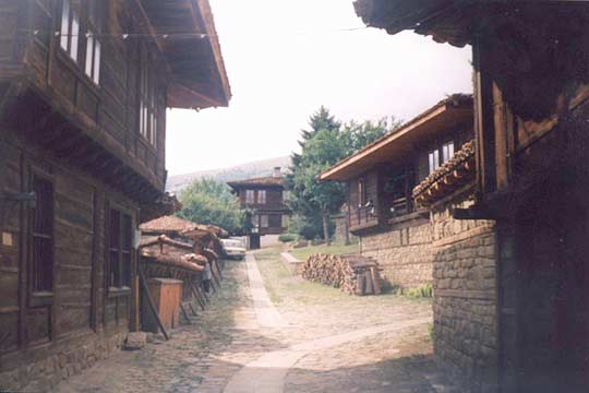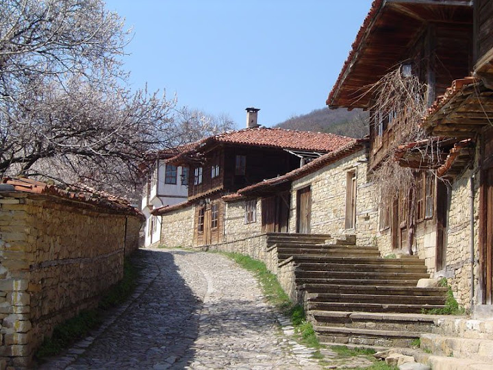
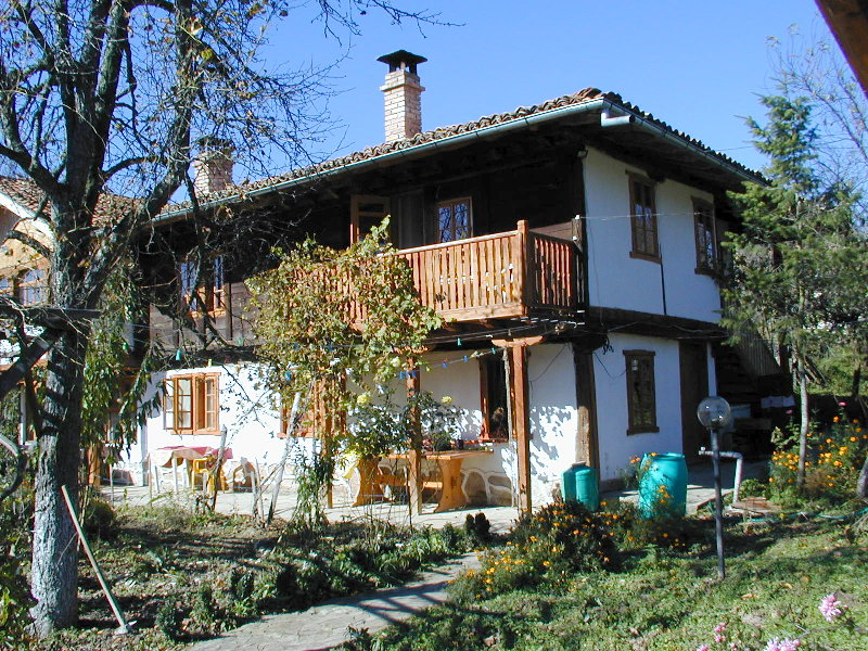
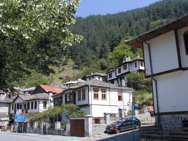
View of Zheravna
|
Zheravna (Bulgarian:
Жеравна,
from жерав, zherav, "crane")
is a village in central eastern
Bulgaria, part of
Kotel municipality,
Sliven Province. The village, set in a
small valley at the southern foot of the
eastern
Balkan Mountains, is an architectural
reserve of national importance consisting of
more than 200 wooden houses from the
Bulgarian National Revival period (18th
and 19th century), and a quickly developing
tourist destination.
The village emerged between the 12th and 14th century
and grew to become a cultural and handicraft
centre in the 18th century. As the local
population came to wealth, the architectural
appearance of the village was shaped by one-
or two-storey wooden houses surrounded by
stone walls and cobblestone alleys.
Popular sights in the village include the museum house
of the merchant Rusi Chorbadzhi from the
early 18th century, the Church of St
Nicholas inaugurated in 1834 and housing
icons from the 18th and early 19th century,
the museum house of the noted writer
Yordan Yovkov born in 1880, the art
gallery occupying the old class school and
the museum house of the educator Sava
Filaterov.
As of September 2005
the village has a population of 460
GRBulgaria
and the mayor is Lachezar Germanov. Zheravna
lies at
42°50′N 26°28′E, at 579 m above
sea level.
Full
article here... Source:
Wikipedia, free Encyclopedia
|
|

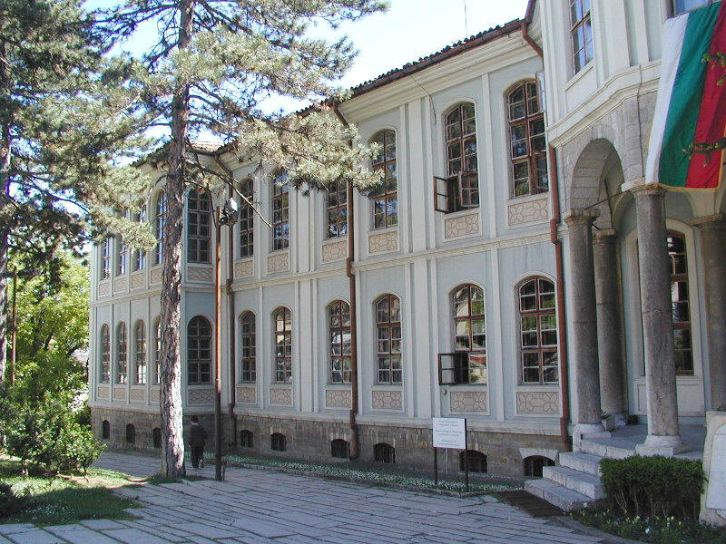
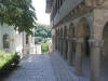
Town of Kotel -
Ethnography Museum
|
Kotel
(Котел, "cauldron") is a town in central
Bulgaria,
part of
Sliven Province. Kotel has a population of 7,179 and is known for the
numerous personalities of the
Bulgarian National Revival that are somehow connected to the town, such as
politicians
Alexander Bogoridi and
Stefan Bogoridi, enlighteners
Sophronius of Vratsa and
Petar
Beron, public figure
Gavril Krastevich, revolutionary
Georgi Rakovski, as well as
World
War II prime minister
Dobri Bozhilov. It has a well-known music school and a large talented Gypsy
(Romany)
population who can be found playing in restaurants and orchestras all over
Bulgaria. Because of its situation in the mountains Kotel is also a popular
healthy resort for the cure of diseases such as TB. Kotel has been a centre for
carpet making and there is a museum devoted to the craft.
Source:
Wikipedia, the free encyclopedia
|
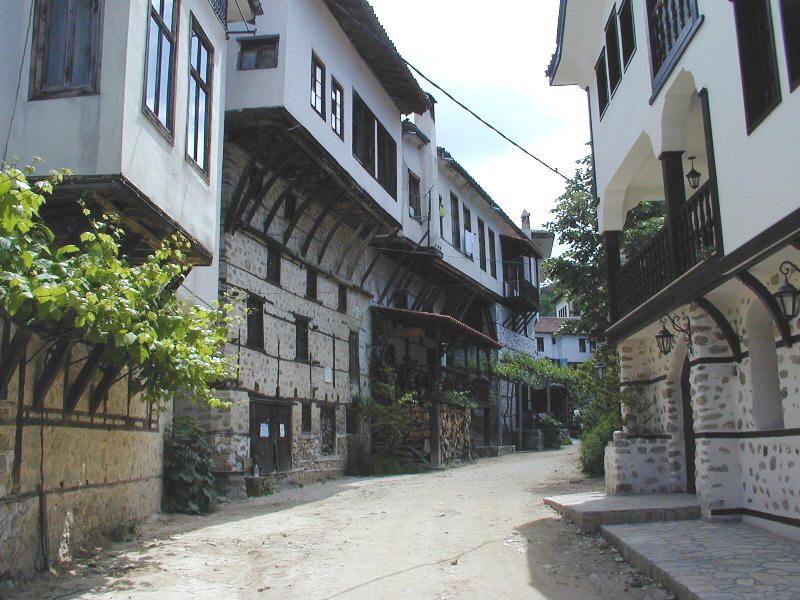
Typical Bulgarian National
Revival architecture in Elena
|
Elena is an old
settlement founded in the
15th century. During the
18th and
19th century it established itself as a centre of crafts, trade and
education. There are several architectural ensembles preserved dating
back to the
Bulgarian National Revival and comprising about 130 old houses.
Wall-to-wall construction forms interesting street silhouettes. The
houses have stone basements with white-washed or wooden walls of the
upper floor with protruding bays above.
Full
article and more pictures you can find here...
Source:
Wikipedia, the free encyclopedia
More pictures here:
Nikola
Gruev's Photo Album - Elena |

Old architecture in Zlatograd
|
Zlatograd
is
a town in
Bulgaria, 60
km from
Smolyan, its name literally translates to
Gold
town. It is located in a valley between the eastern
and central massif of the
Rhodope mountains. The
Greek border lies just 5 km away from the town.
Administrative location:
Zlatograd municipality is spread on a territory of 175.8
km². It has common borders with the municipalities of
Kirkovo and
Dzhebel (to the east),
Nedelino (to the north),
Madan and
Rudozem (to the west) and with the Republic of
Greece
(to the south) - on the borderline between
Bulgaria and Greece)
Relief: mountainous;
Climate: The
municipality is included in the transient-Mediterranean
climate region.
Mineral resources:
lead-zinc
ore;
Water resources:: The
territory of the municipality is crossed by Varbitza
river which is 98.1 km long and its catchment basin is
1202.8 km. Nedelinska and Kushlenska rivers are
tributaries of
Varbitza.
Full
article here ... Source:
Wikipedia
More pictures here:
Nikola Gruev's Photo Album - Zlatograd
|
View of Shiroka Laka
|
Shiroka Laka is famous for its
authentic Rhodopean houses set in tiers on both banks of the local
river. The old houses were designed in the characteristic architectural
style of the Rhodopes by the noted local building masters.
Full
article and more pictures you can find here ... Source:
Wikipedia
More pictures here:
Nikola
Gruev's Photo Album - Shiroka Luka |
The Lyutov House, a mid-19th century house
in Koprivshtitsa
|
Koprivshtitsa (Bulgarian:
Копривщица;
[ku.'priv.ʃti.ʦə],
from the Bulgarian word коприва,
kopriva, meaning "nettle")
is a historic town in
Sofia Province, central
Bulgaria, lying on the
Topolnitsa River among the
Sredna Gora mountains. It was one of the centres of the
April Uprising in 1876 and is known for its authentic
Bulgarian architecture and for its
folk music festivals, making it a very popular tourist
destination.
Koprivshtitsa is one of the characteristic Bulgarian towns, still
preserving the atmosphere of the
Bulgarian National Revival period of the 19th century.
Sunshine colours and romance are what characterize the typical 19th
century atmosphere preserved and lingering in Koprivshtitsa. Every single
house here is part of Bulgaria's history. It was here that the first shot
of the April Uprising against Ottoman rule rang out in 1876. Although
drenched in blood, the uprising resounded in all of Europe. As of September 2005, the town has a population
of 2,683GRBulgaria
and the mayor is Nikola Kamenarov. Koprivshtitsa is
located at 1,030 m above sea level, at
42°38′N 24°21′E.
Full
article here ... Source:
Wikipedia, the free Encyclopedia
|
 Ethnography Complex Etara, Gabrovo
|
The Etar Architectural-Ethnographic Complex
(Bulgarian:
Архитектурно-етнографски
комплекс „Етър“, usually referred to as Етъра, Etara) is an
open-air museum 8
km south of
Gabrovo in northern
Bulgaria that presents the Bulgarian customs,
culture and craftsmanship. It spans over an area of 7
ha and contains a total of 50 objects, including
water installations and houses with craftsmen's
workshops attached. As a whole, the complex's goal is to
illustrate the architecture, way of life and economy of
Gabrovo and the region during the
Bulgarian National Revival.
The museum's construction started in
1963 under the direction and project of Lazar Donkov.
The pre-existing Karadzheyka
water-mill, built around
1780, was thoroughly reconstructed, with the other
objects being constructed later. The complex was opened
on
7 September
1964 and proclaimed a
national park in
1967, as well as a monument of culture in
1971.
The park features typical
Bulgarian revival houses with two floors, bay
windows, a clock tower, and a beautifully decorated
house by Saakov featuring 21 windows. Using original
instruments and following the old traditions, locals
represent around 20 characteristics of the regional
crafts such as
wood-carving,
pottery,
coppersmith crafts,
furriery,
cutlery making,
needlework etc. There are shops for souvenirs,
tourists can enjoy the luxury of a local three star
hotel with a bar and a restaurant. There are numerous
restaurants in the park where tourist could enjoy the
delicacies of local
Bulgarian cuisine ...
Full
article here... Source:
Wikipedia
|
Town of Melnik
|
Melnik (Мелник)
is the smallest settlement classified as a town in the
Republic of Bulgaria and is located in
Blagoevgrad Province (sometimes referred to as Pirin
Macedonia), in the southwestern
Pirin Mountains, about 440 m above sea level. The
town is an architectural reserve and 96 of its buildings
are cultural monuments.
According
to archaeological evidence, the first to settle in the
area were the
Thracians. Centuries later, the presence of the
Romans left the town one of its landmarks - the
Ancient Roman bridge, which is still preserved. The
Slavs who later came in these parts named the
settlement Melnik after the sand formations
surrounding it on all sides (the
Slavonic word "mel" means "white clay,
chalk"). Melnik became a part of the
Bulgarian state under the rule of
Khan
Presian (836-852)
and prospered greatly in the period. Melnik became the
capital of an independent feudal principality ruled by
Despot Slav, a descendant of the
Asen dynasty, in
1209, and passed through an economic and cultural
upsurge during his reign. The town continued to flourish
under
Tsar
Ivan Asen II because of the duty-free trade with
Venetian-ruled
Dubrovnik.
Full
article and more pictures you can find here... Source:
Wikipedia
More pictures here:
Nikola
Gruev's Photo Album - Melnik |
|
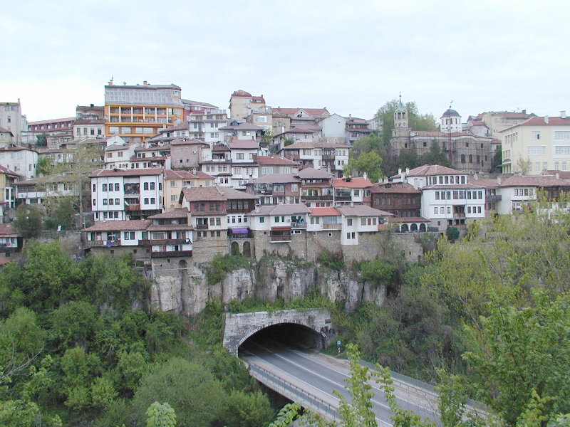
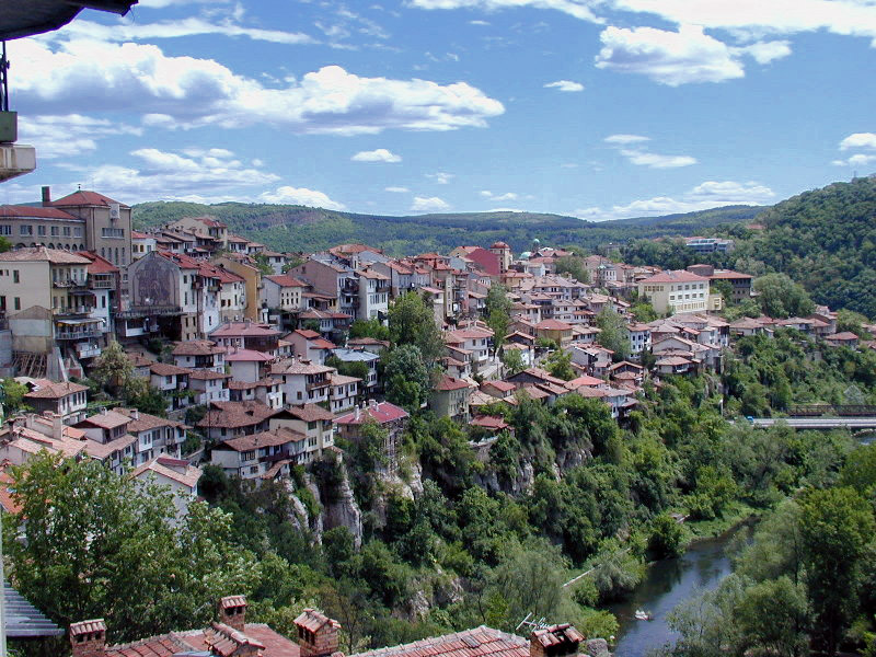
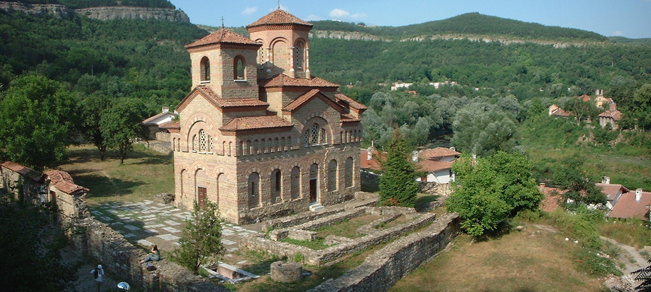
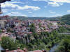
View of Veliko Tarnovo

 |
Veliko Tarnovo
(Bulgarian:
Велико Търново; also
transliterated as Veliko Turnovo, is a city in central
northern
Bulgaria and the administrative centre of
Veliko Tarnovo Province. It is located on the
Yantra River and is famous as the historical capital of the
Second Bulgarian Empire, attracting many tourists with its
unique architecture.
Veliko Tarnovo is one of the oldest settlements
in Bulgaria, having a history of more than 5
millennia, as the first traces of human presence
dating from the 3rd millennium BC are on
Trapezitsa Hill.
The historical
part of town, which was the capital of Bulgaria
during the
Second Bulgarian Empire, lies on three hills
–
Tsarevets, Trapezitsa and
Sveta Gora (Holy Mountain). Veliko Tarnovo
is the place where brothers
Asen and
Peter declared the end of
Byzantine rule in Bulgaria, proclaiming the
city a capital. Veliko Tarnovo grew quickly to
become the strongest Bulgarian fortification of
the Middle Ages between the 12th and 14th
century and the most important political,
economic, cultural and religious centre of the
empire. In the 14th century as the
Byzantine
Empire weakened Tarnovo claimed to
be the
Third Rome based on its preeminent cultural
influence in the
Balkans and the
Slavic Orthodox world.
Full
article and more pictures you can find here... Source:
Wikipedia
More pictures here:
Nikola Gruev's
Photo Album - Veliko Tarnovo
|
|
![]() ©2008
Bulgaria ©2008
Bulgaria
Emil Manchev
|